Jun 24, 2026
Heat islands in Bordeaux Lac: how Nhood evaluates the impact of renaturation with UrbanThink
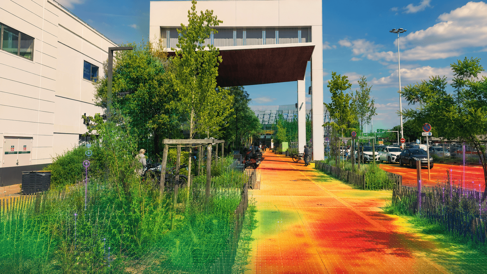
Commercial zones are among the areas particularly exposed to high temperatures. Large mineral surfaces, parking lots, buildings, and the low presence of natural soils promote heat accumulation during the day, followed by its gradual release into the environment.
At Bordeaux Lac, Nhood relies on UrbanThink's analyses and modeling to better understand this phenomenon, measure the impact of the initial renaturation works, and identify the levers to mobilize to sustainably strengthen the climate resilience of the site.
The objective is not just to green the area, but to understand where to act, how to combine solutions, and at what scale to intervene to achieve a significant cooling effect.
Why do commercial zones concentrate heat?
Commercial zones have often been designed around automobile accessibility, with vast parking lots, traffic lanes, and buildings surrounded by impermeable surfaces.
These mineral surfaces absorb a significant portion of solar radiation during the day. Asphalt, concrete, and certain roofs can thus reach very high temperatures before gradually releasing the accumulated heat.
At the same time, the low presence of vegetation and natural soil limits natural cooling mechanisms. Water infiltrates less easily, evapotranspiration decreases, and shaded areas remain scarce.
This combination of soil sealing, lack of shade, and the thermal inertia of materials promotes the formation of heat islands.
The consequences are numerous. They affect the comfort of visitors and employees, the attractiveness of outdoor spaces, the energy consumption of buildings, rainwater management, and, more broadly, the site's capacity to adapt to more frequent heat episodes.
Bordeaux Lac, a highly mineralized site
The Aushopping Bordeaux Lac shopping center is located at the northern entrance to Bordeaux, near the lake and the A630 motorway. This sector, gradually urbanized since the 1960s, now gathers numerous buildings, equipment, roads, and parking spaces.
The successive development of the different plots has created a fragmented ensemble, marked by many artificialized surfaces and limited ecological continuities.
The analyses carried out on the site reveal in particular a significant difference between the global perimeter of the commercial zone, which extends over more than 53 hectares, and that of the shopping center itself.
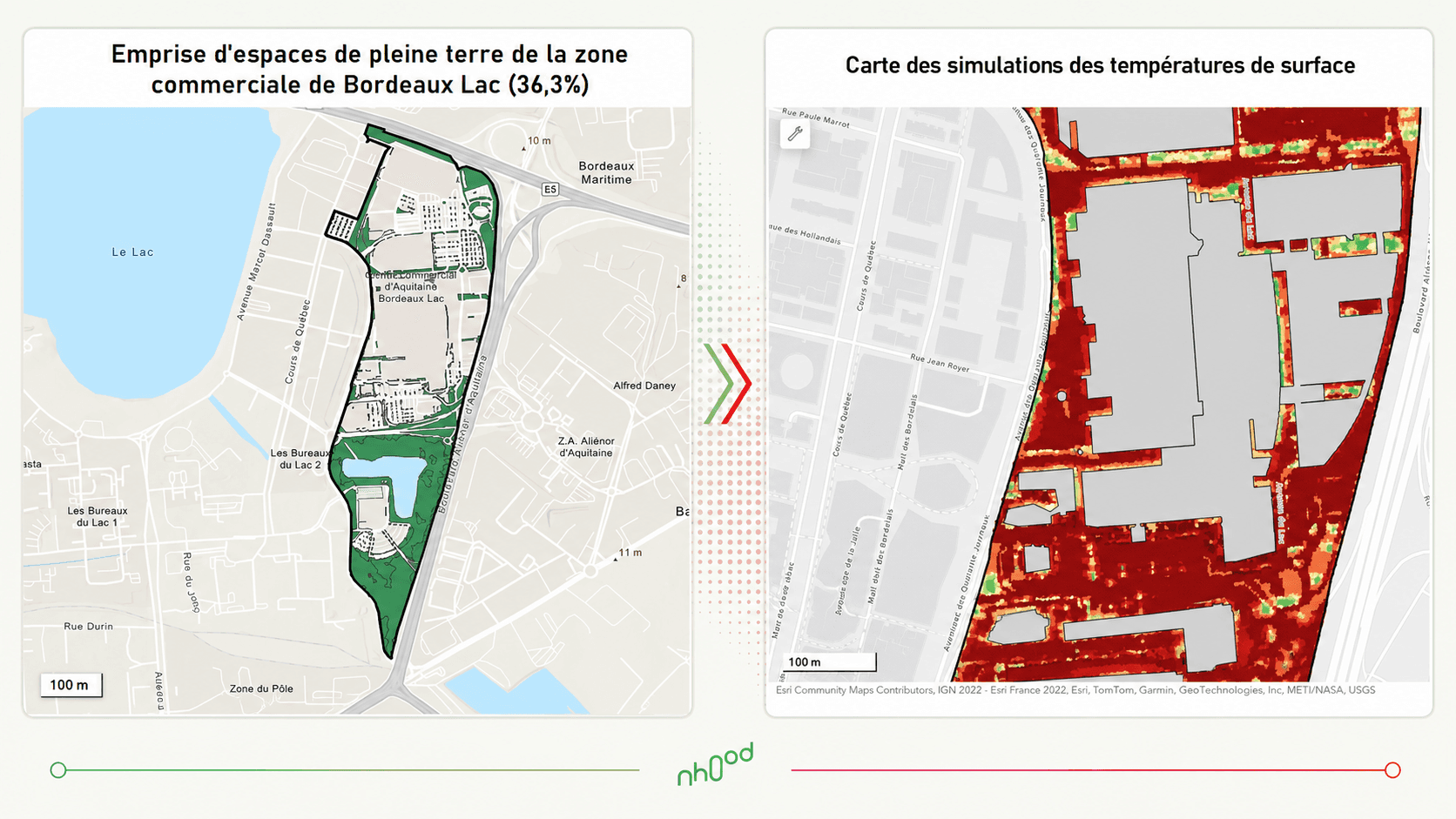
The share of natural soil reaches 36.3% on the global perimeter, but only 15.4% on the narrower perimeter of the shopping center.
This low presence of natural soils reduces the site's capacity to infiltrate water, support significant vegetation, and benefit from the associated cooling effects.
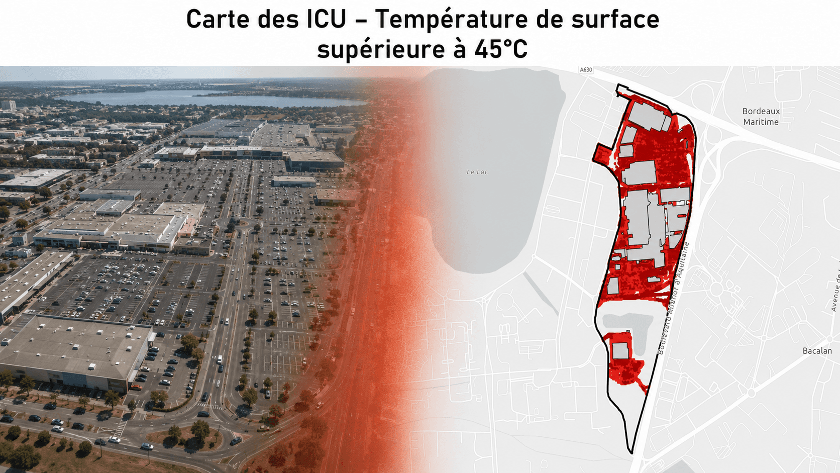
The maps produced by UrbanThink show a maximum average land surface temperature value of 38.8 °C on a hot July day. Some areas, particularly parking lots and entirely sealed surfaces, can exceed 45 °C.
The most mineralized spaces thus become the main hot spots of the site.
How UrbanThink models surface temperatures
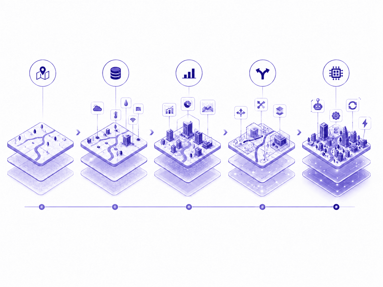
To precisely understand the thermal behavior of the site, UrbanThink cross-references several sources of geographical and environmental data.
The analysis is based in particular on open data from Bordeaux Métropole, the BD TOPO and the CosIA land cover data from the IGN, LiDAR HD, surveys carried out on-site, as well as models developed by UrbanThink.
This information makes it possible to characterize the nature of the soils, the presence of vegetation, buildings, heights, shaded areas and the various artificialized surfaces.
They are then integrated into the models in order to produce detailed maps of surface temperatures and to identify the most exposed areas.
Mapping thus transforms a diffuse phenomenon into localized and actionable information.
Rather than considering the entire shopping center as a single hot zone, the modeling makes it possible to distinguish parking lots, forecourts, exposed facades, vegetated areas and spaces already benefiting from better shading.
This reading facilitates the prioritization of interventions and allows investments to be focused on the sectors where the expected benefits are the greatest.
Compare scenarios to measure the effect of developments
The value of modeling does not lie solely in identifying the hottest areas. It also allows testing several site transformation hypotheses and comparing their effects before starting work.
UrbanThink has thus modeled the initial state of Bordeaux Lac, then two development scenarios, under identical extreme weather conditions.
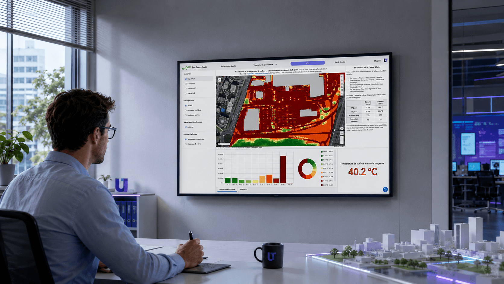
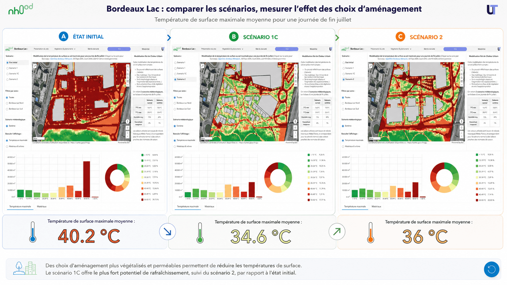
In the initial state, the average maximum surface temperature reaches 40.2 °C. This situation is explained in particular by the significant presence of black asphalt, which represents nearly 34.8% of the modeled land cover. The maps show large areas between 50 and 55 °C, mainly in parking lots, traffic lanes and the most mineralized sectors.
Scenario 1C plans a significant transformation of land cover, with a reduction in the share of black asphalt to around 14.9% and an increase in vegetated surfaces. In this configuration, the average maximum surface temperature drops to 34.6 °C, representing a modeled decrease of 5.6 °C compared to the initial state.
Scenario 2 also reduces the most mineral surfaces, but retains a slightly larger share of black asphalt, close to 18%. The average maximum surface temperature then reaches 36 °C, representing a modeled decrease of 4.2 °C compared to the initial state.
Both scenarios therefore clearly improve the thermal behavior of the site, but scenario 1C shows the most favorable results under the studied conditions.
This comparison shows that the amount of vegetation is not the only determining factor. The location of trees, the continuity of planted areas, the reduction of dark surfaces, the nature of coatings and the overall organization of the site also strongly influence surface temperatures.
Modeling thus allows going beyond a logic based on the number of trees planted to evaluate the overall performance of each development scenario.
Why the cooling effect remains localized
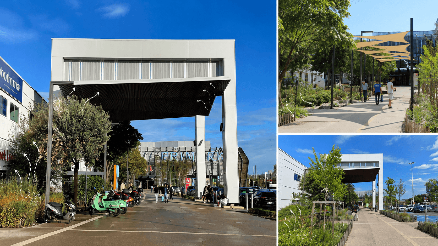
Simulations carried out after the initial works show a cooling effect in the directly renatured areas, particularly near the entrance to the shopping center.
However, the majority of the site remains exposed to high surface temperatures. Mineral surfaces, parking lots, and untreated areas continue to accumulate a significant amount of heat.
Revegetation improves local conditions, but its effect remains limited when it is deployed only over a small part of a highly artificialized site.
It is also important to specify that the simulations carried out before and after the works are based on different meteorological assumptions. The maps produced after the renaturation correspond to a heatwave situation, with an average air temperature of 40.8 °C.
They therefore make it possible to identify the thermal behavior of the various spaces and the localized effects of the developments, but they should not be used to announce a precise decrease in temperature between the initial situation and the renovated situation.
Another factor must be taken into account. Newly planted trees do not produce their maximum effect immediately. Their capacity to provide shade and cool the air increases gradually with their growth.
The time required for development and the time required for climate benefits are not always the same.
Moving from isolated actions to a global climate strategy
The results highlight the need to move beyond an approach based on a single solution.
Renaturation remains an essential lever, but it must be combined with other actions adapted to the characteristics of the site.
Increasing open ground, creating green continuities, developing shade, and improving water management can be complemented by reflecting on the color and albedo of materials, building morphology, parking lot coverings, or even air circulation.
Green and blue networks can also play an important role. By linking the green spaces located around the lake, the residential sectors, and the commercial zone, they can strengthen natural cooling mechanisms and prevent developments from remaining isolated from one another.
The effectiveness of a strategy against heat islands depends as much on the quality of the developments as on their continuity and scale of deployment.
For a site of more than 53 hectares, transformation therefore requires progressive programming, coordinating short-term interventions with a long-term vision.
How ThinkCities® helps compare development scenarios
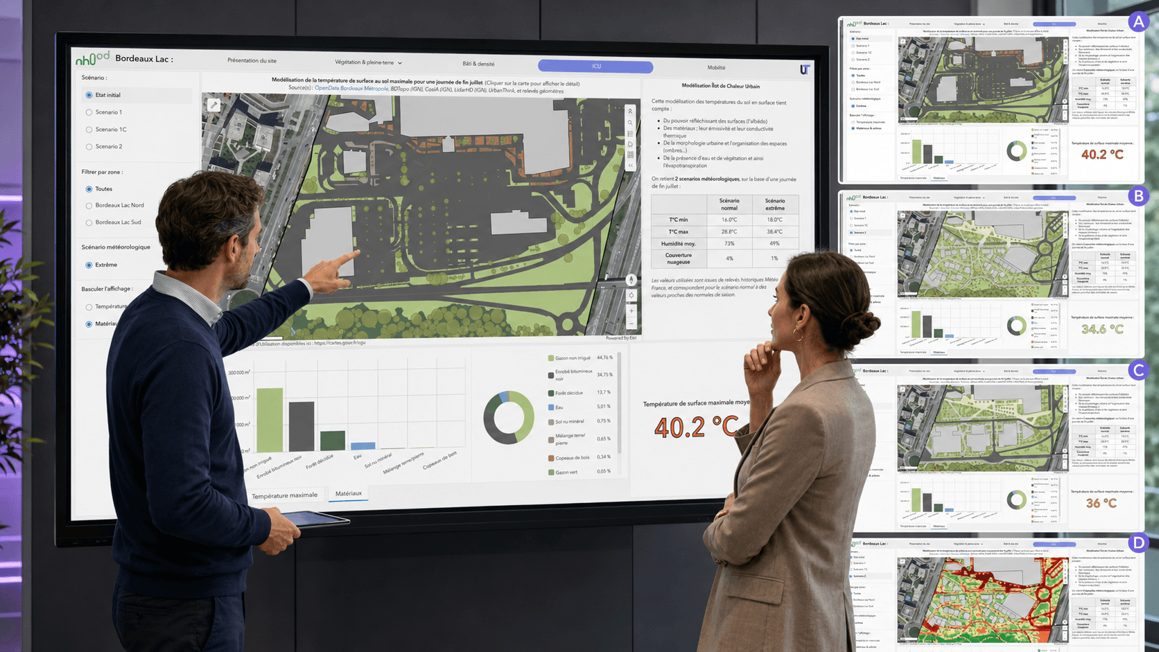
ThinkCities® brings together data relating to soil, buildings, vegetation, water, and climatic conditions into a single platform.
Managers can visualize the most exposed areas, compare the characteristics of different spaces, and identify the sectors where action should be prioritized.
The platform also allows for the simulation of several development scenarios. It thus becomes possible to compare the potential effects of soil de-sealing, new plantings, the creation of shade structures, or the use of more reflective materials.
The digital twin helps test choices before implementation and objectify trade-offs between impact, cost, and feasibility.
After the works, the same indicators can be used to monitor the evolution of the site, measure the effects of the developments, and progressively adjust the strategy.
The study conducted at Bordeaux Lac thus shows that data and modeling do not replace action. They allow it to be better targeted, evaluated, and integrated into a coherent approach at the site scale.
Faced with heat islands, the challenge is not only to add more vegetation, but to build a global strategy that is measurable and adapted to actual uses.
Would you like to map the heat islands of your sites and compare several renaturation scenarios? Discover how UrbanThink and ThinkCities® can support you.