May 20, 2026
Digital twin maturity: a strategic, multi-level challenge for smart territories

Today, the smart transformation of territories demands new approaches to urban development, environmental management, and infrastructure steering. In a context defined by the ecological transition, climate risks, energy pressure, and the multiplication of data, decision-makers need tools capable of offering a more global, dynamic, and operational vision of their territory.
Territorial digital twins are fully part of this evolution. By leveraging technologies such as the Internet of Things, artificial intelligence, big data, cloud computing, or even BIM, they allow the collection, structuring, analysis, and visualization of urban, environmental, and technical data.
But a digital twin is not limited to a 3D representation of a city, a neighborhood, or a site. Its value depends above all on its level of maturity, that is to say, its capacity to move from the simple representation of reality to analysis, simulation, and decision-making support.
What is the maturity of a digital twin?
The maturity of a digital twin corresponds to the level of understanding it brings to a problem, an objective, an asset, a process, or a phenomenon.
A mature digital twin does not merely provide data. It progressively allows the production of knowledge, the formulation of recommendations, and, in the most advanced models, moves toward the control or automation of certain actions.
We can thus distinguish several capabilities: data collection, analysis, prediction, optimization, and autonomy. This progression transforms the digital twin into a true strategic steering tool.
Maturity Levels of the Territorial Digital Twin
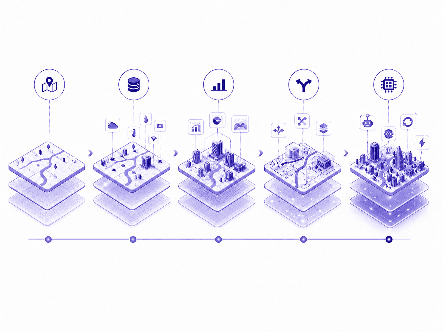
The maturity of territorial digital twins is generally described through several levels, depending on their degree of data integration, analytical capacity, and use of forecasting or simulation models.
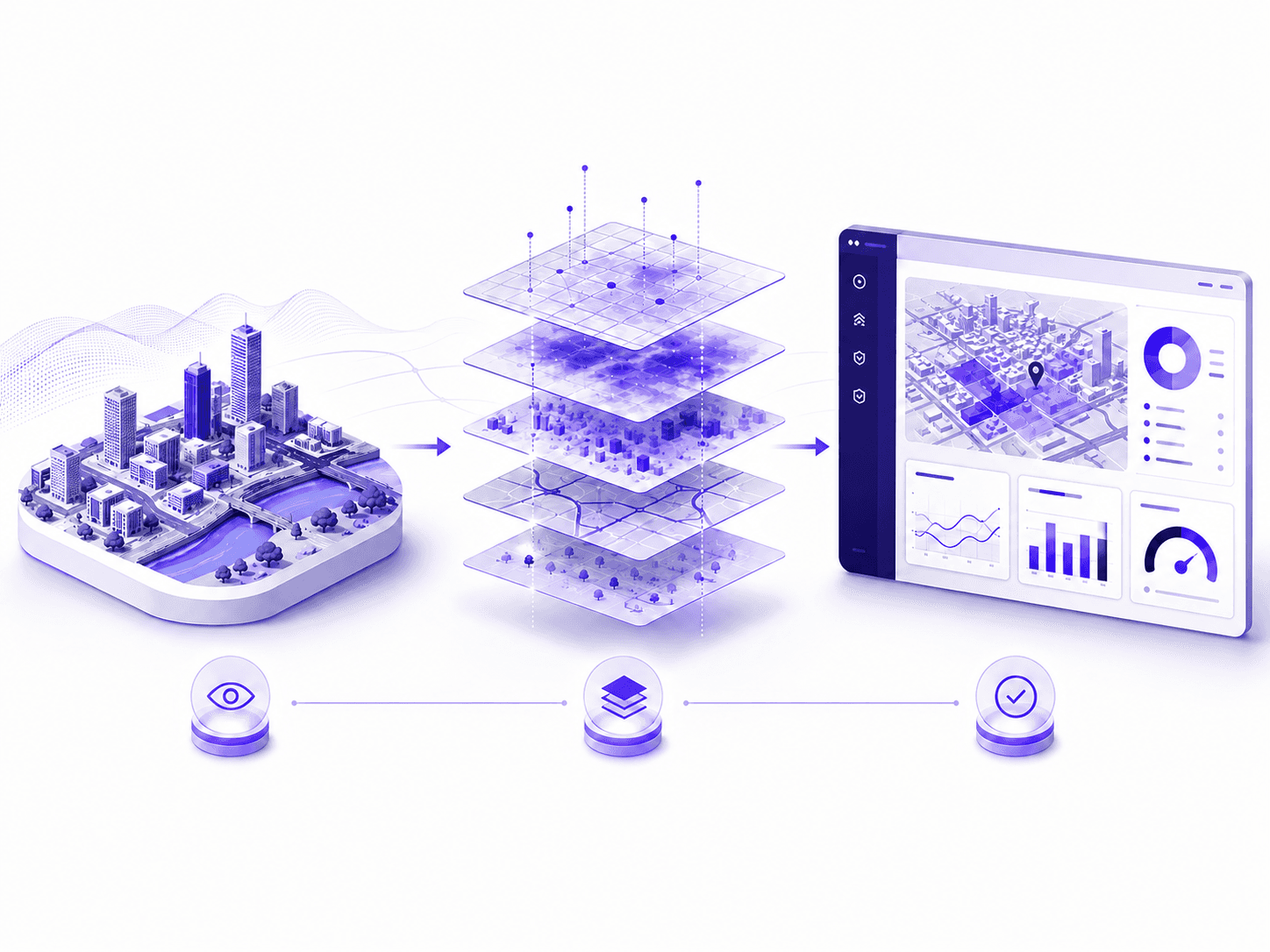
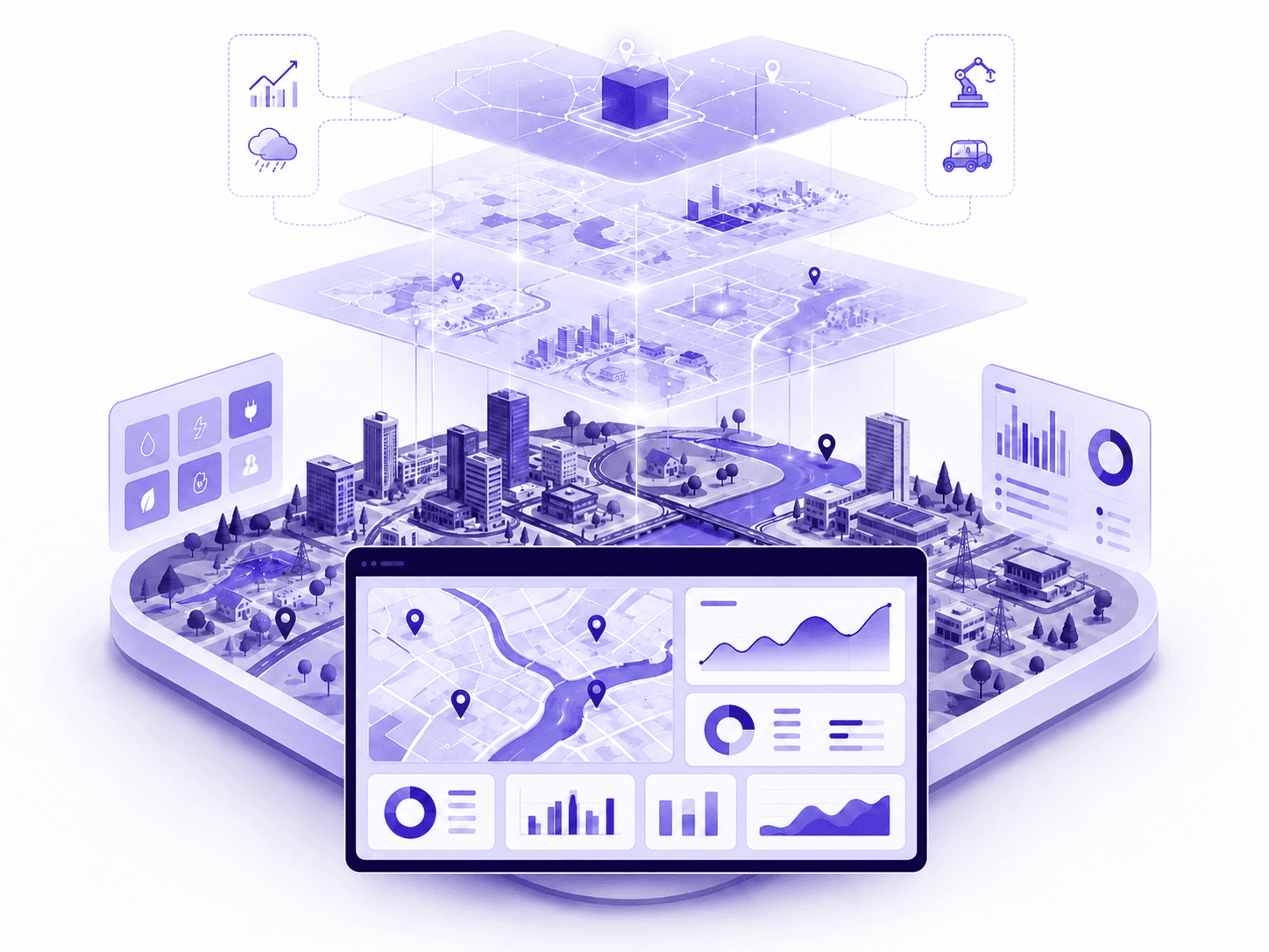
The first level is the terrain model. It consists of representing the geospatial foundation of the territory: geographical, topographical, cadastral characteristics, environmental data, vulnerability zones, or climatological elements. This level structures an initial spatial reading of what exists.
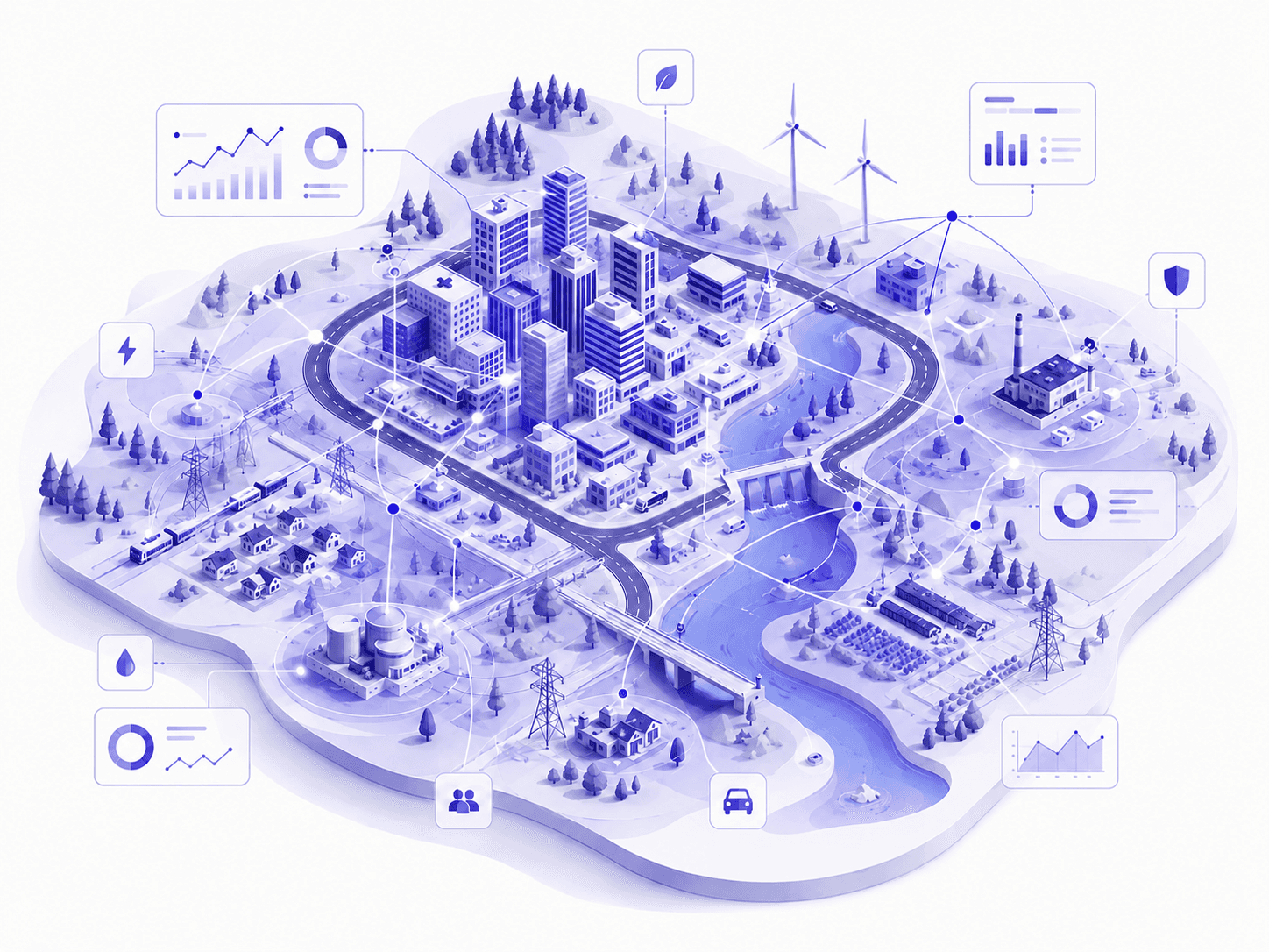
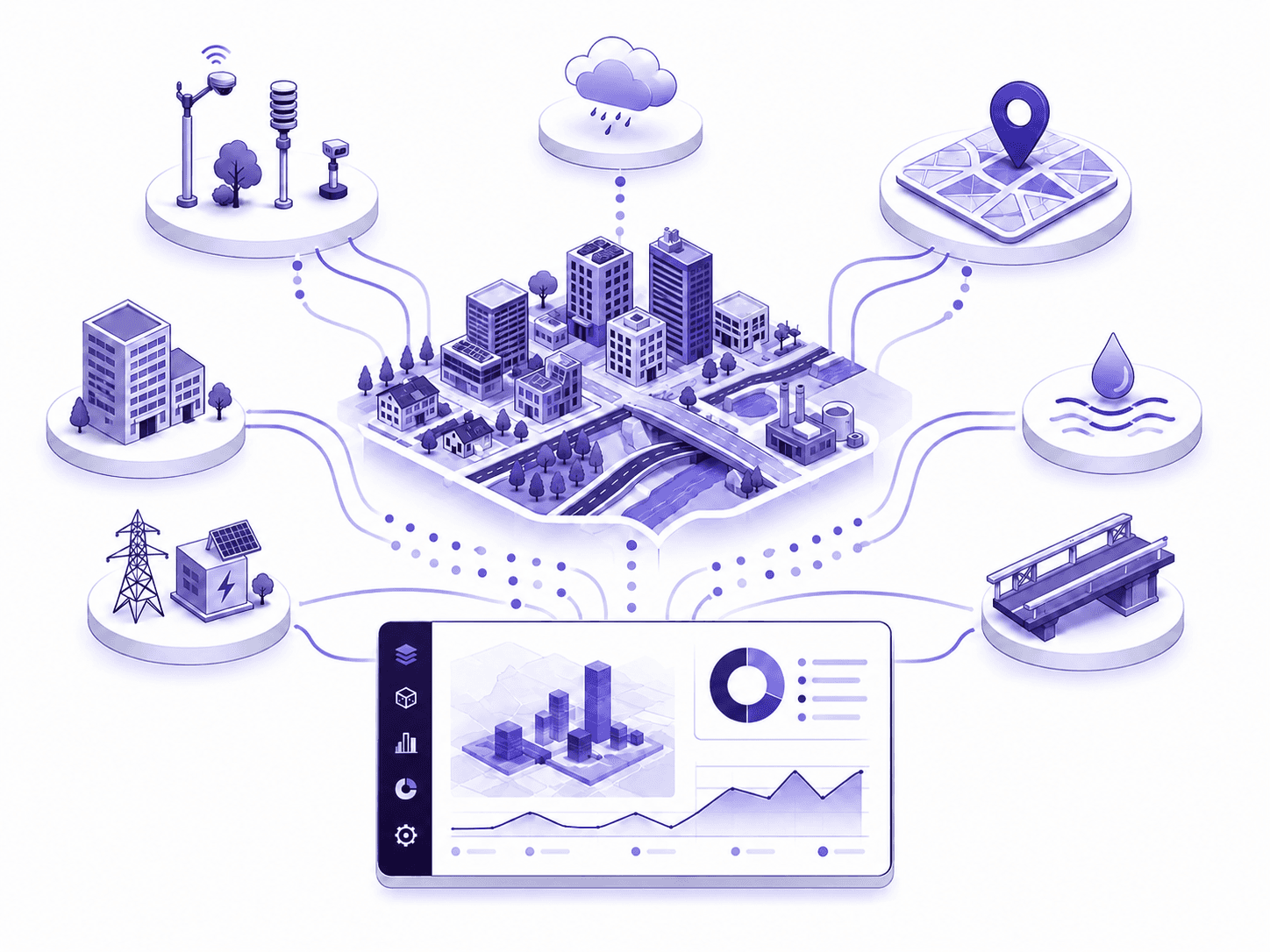
The second level corresponds to the descriptive model. The digital twin then integrates a representation of the territory and its interconnected systems. It can centralize and visualize dynamic data, sometimes in real time, such as energy consumption, water data, environmental indicators, or information from sensors.
The third level is the informative model. At this stage, data is no longer just displayed. It is analyzed, compared, and contextualized. The digital twin makes it possible to better understand the performance of a site, an asset, or a territory. It then becomes a decision-making aid tool.
The fourth level corresponds to the predictive model. Building on previous data and analysis, the digital twin applies forecasting, simulation, and scenario-planning models. It becomes possible to test multiple hypotheses, evaluate impacts, or anticipate various future states. It is at this level that the digital twin takes on a particularly strategic dimension.
Finally, the fifth level is the autonomous model. The digital twin can then automatically identify the optimal scenario and control the real system accordingly. In the case of cities and territories, this level remains largely prospective.
Where Are We Today?
Academic work and industrial feedback show that the majority of territorial digital twins are still situated between levels 2 and 3. Many projects remain focused on modeling, visualization, data centralization, or real-time monitoring.
Few projects fully exceed level 4, and none yet present a completely autonomous level within the territorial context. The autonomous city controlled by an intelligent digital twin therefore remains a long-term goal.
The current challenge is rather to move beyond simple visualization toward digital twins capable of analyzing, comparing, forecasting, and informing the choices of decision-makers.
The UrbanThinkPlatform Approach
UrbanThink Platform is part of this journey toward maturity.
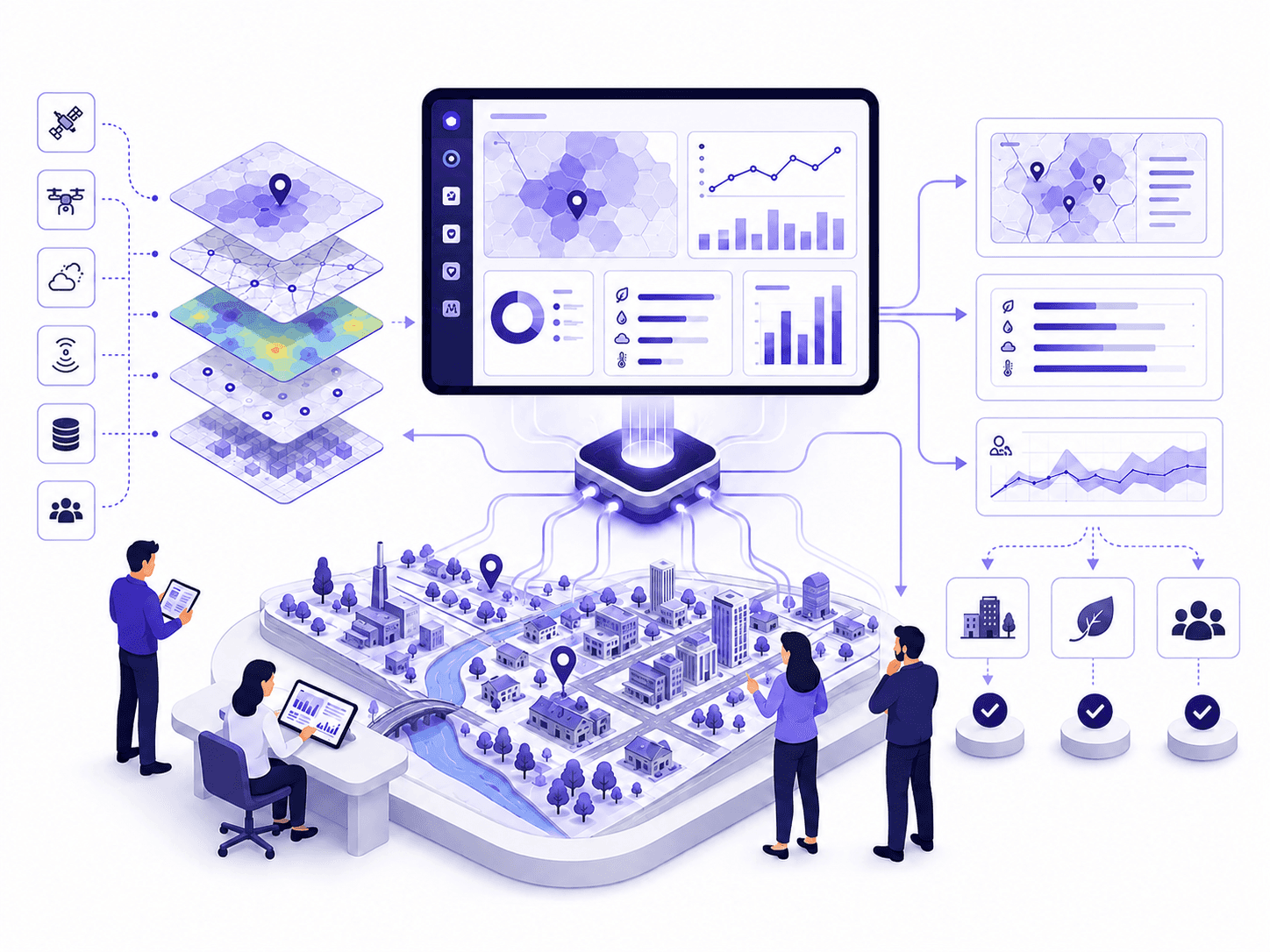
The platform offers ThinkCities a management cockpit that makes it possible to represent the field, centralize data, monitor territorial indicators, analyze historical and real-time performance, and then model different scenarios in order to evaluate their impacts.
By integrating geographical, environmental, energy, architectural heritage, and operational data, UrbanThink makes it possible to build a holistic vision of a site, an asset portfolio, or a territory. The platform thus helps organizations better understand their challenges, prioritize their actions, and steer their transitions.
With this in mind, UrbanThink can be positioned around a maturity level of 4.1, specifically by integrating scenario simulation and impact assessment.
A tool to better understand, anticipate, and act
The maturity of the digital twin is therefore a strategic challenge for smart territories. The more mature a digital twin becomes, the more it allows scattered data to be transformed into useful knowledge, and then into actionable decisions.
The real challenge is not just to digitize the territory. It is to build tools capable of improving understanding, enhancing management, and supporting more informed decisions.
It is this evolution that makes the digital twin an essential lever for smarter, more resilient territories that are better prepared for the challenges of tomorrow.