Feb 21, 2024
Everything you need to know about Digital Twins

Virtual Representation of the Real World and Data Incarnation
Imagine an exact and dynamic replica of a physical object, an industrial process, or even an entire city, powered in real-time by data from sensors and computer systems.
This is precisely what the digital twin offers, paving the way for a multitude of applications and possibilities in various fields, from industry to healthcare to urban planning.
It is also a key tool for decarbonization and assistance in the ecological transition. Indeed, thanks to the digital twin, it is possible to test scenarios, optimize operations, detect inefficiencies, and develop solutions to reduce energy consumption and carbon emissions.

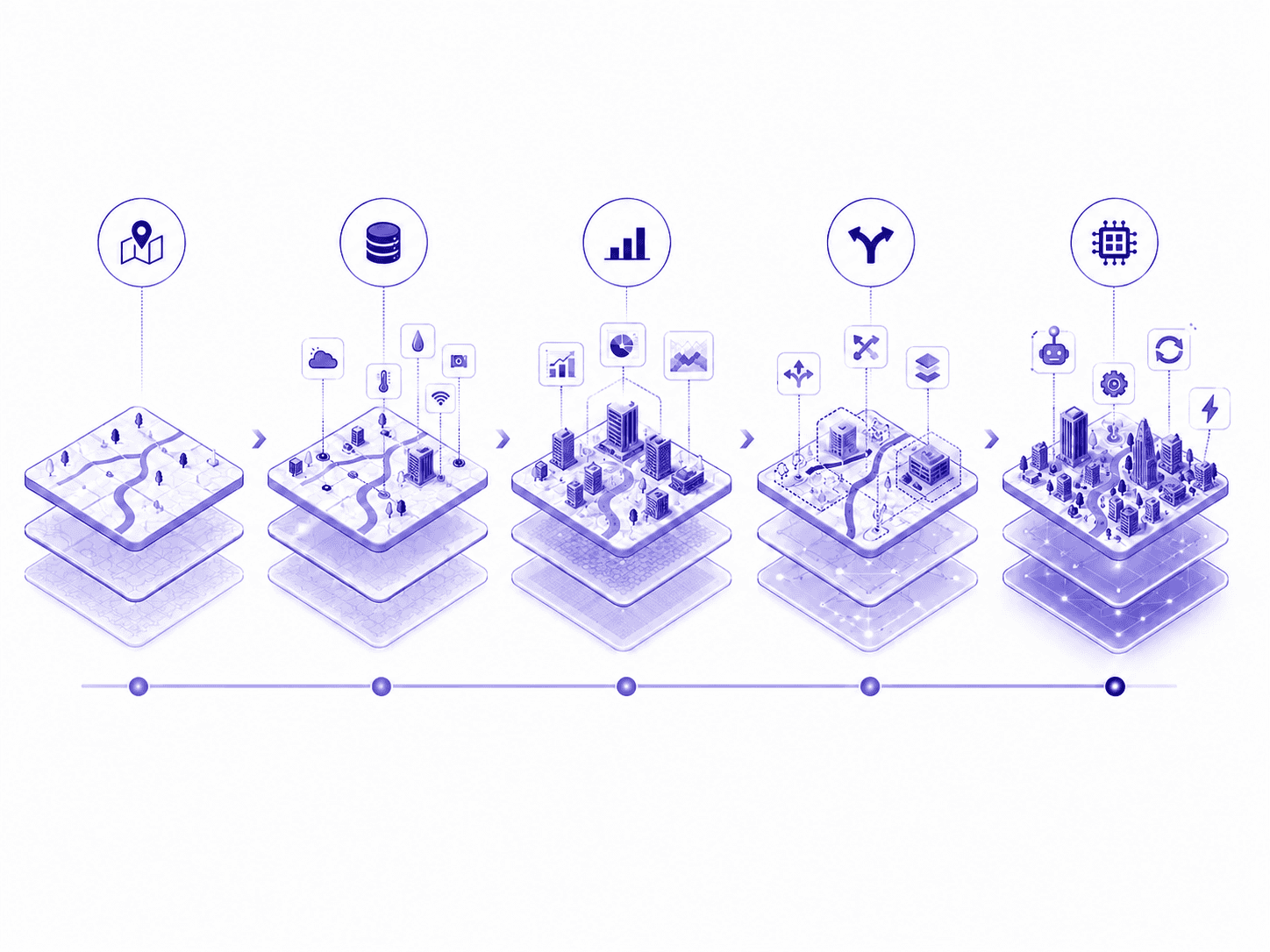
Digital Model, Hypervisor and Digital Twin
The digital model is a virtual and static 3D representation of a building, infrastructure, or territory on a digital visualization medium, incorporating data from various sources such as geographic information systems (GIS), computer-aided design (CAD), Building Information Modeling (BIM), and other similar technologies. It allows for the geometric characteristics (metric, volume) of objects depending on the level of detail (LOD) and provides information on the nature of all its objects. It also provides a comprehensive visualization of urban or development projects. Primarily used as a communication and consultation tool, the digital model is often created at the scale of an object or development projects.
Hypervisor is a centralized software representing a structure (industrial unit), a territory, designed to monitor, control, supervise operations, and execute actions on points of a system of a site or territory. It is essentially a management and supervision software that collects real-time data from sensors, equipment, and production systems on the site, then presents it intuitively in the form of a dashboard via a user interface. It is often deployed at the scale of industrial units such as wastewater treatment plants or refineries.
Digital twins are virtual and dynamic 3D representations of a site, territory or physical system. They integrate real-time data from multiple sources, 3D models, temporal information, and other relevant data sources to create a realistic digital simulation of a given environment. These digital twins are not limited to simple visualization or communication of projects as is the case with the digital model, but are also used for monitoring, analysis, and simulation of the operation of a site, a city, or a territory. They are used to understand the urban ecosystem, improve infrastructure and service management, anticipate future needs, and facilitate decision-making by local authorities. They are most often created at the scale of urban, peri-urban, and rural development projects as part of the urban regeneration of cities, towns, and villages.
Applications and Benefits
Digital Models | Hypervisors | Digital Twins | |
|---|---|---|---|
Design and urban planning and detailed 3D sites (Static data) | X | X | |
Urban planning and infrastructure management (Geospatial and temporal data) | X | ||
Real-time monitoring of various parameters and performance of equipment and production processes on the site | X | X | |
Communication and consultation with stakeholders | X | X | |
Facilitates collaboration among teams and stakeholders | X | X | |
Environmental analysis and risk management | X | ||
Analysis and simulation of development scenarios | X | ||
Advanced supervision of digital models and development projects (Geospatial and temporal data) | X | X | |
Better planning and design of projects | X | ||
Better understanding of the urban ecosystem | X | ||
Improvement of infrastructure management | X | X | |
Optimization and anticipation of future needs | X | ||
Informed and anticipated decision-making | X | ||
Promotion and marketing of projects | X | X | |
Documentation and history of projects | X | X | X |

Urbanthink Platform and its Digital Twin tool Thinkcities®
Thinkcities® is a solution that allows for the implementation of digital twins tailored to the levels of geometric requirements (LOD1, LOD2, LOD3, LOD4), content, and specific use cases. It offers a 360° view of both the territory and geospatial data. It is capable of integrating data flows from various sources in real time as well as simulating trajectories. Furthermore, it facilitates systemic analysis through more than 60 indicators spread across 6 major themes: Water Management, Energy and Climate, Corporate Social Responsibility (CSR), Mobility and Accessibility, Ecosystems and Biodiversity, Waste Management.


Our customizable platform fully leverages the potential of real-time data to simulate decarbonization projects, providing comprehensive and accurate reports tailored to the needs of communities, site managers, private companies, etc.…
Some examples of use cases for Thinkcities®:
Air Quality
Cycling Mobility
Heat Islands
Waste Management, Circular Economy
3D Networks
Environmental Impact Study
Tertiary Decree (monitoring and reporting)
Energy Monitoring
Vacancy of premises
Arboretum and biodiversity management
Mobility management and multimodal transport
Infrastructure Safety
Water Management (EU, EP and AEP)
…